
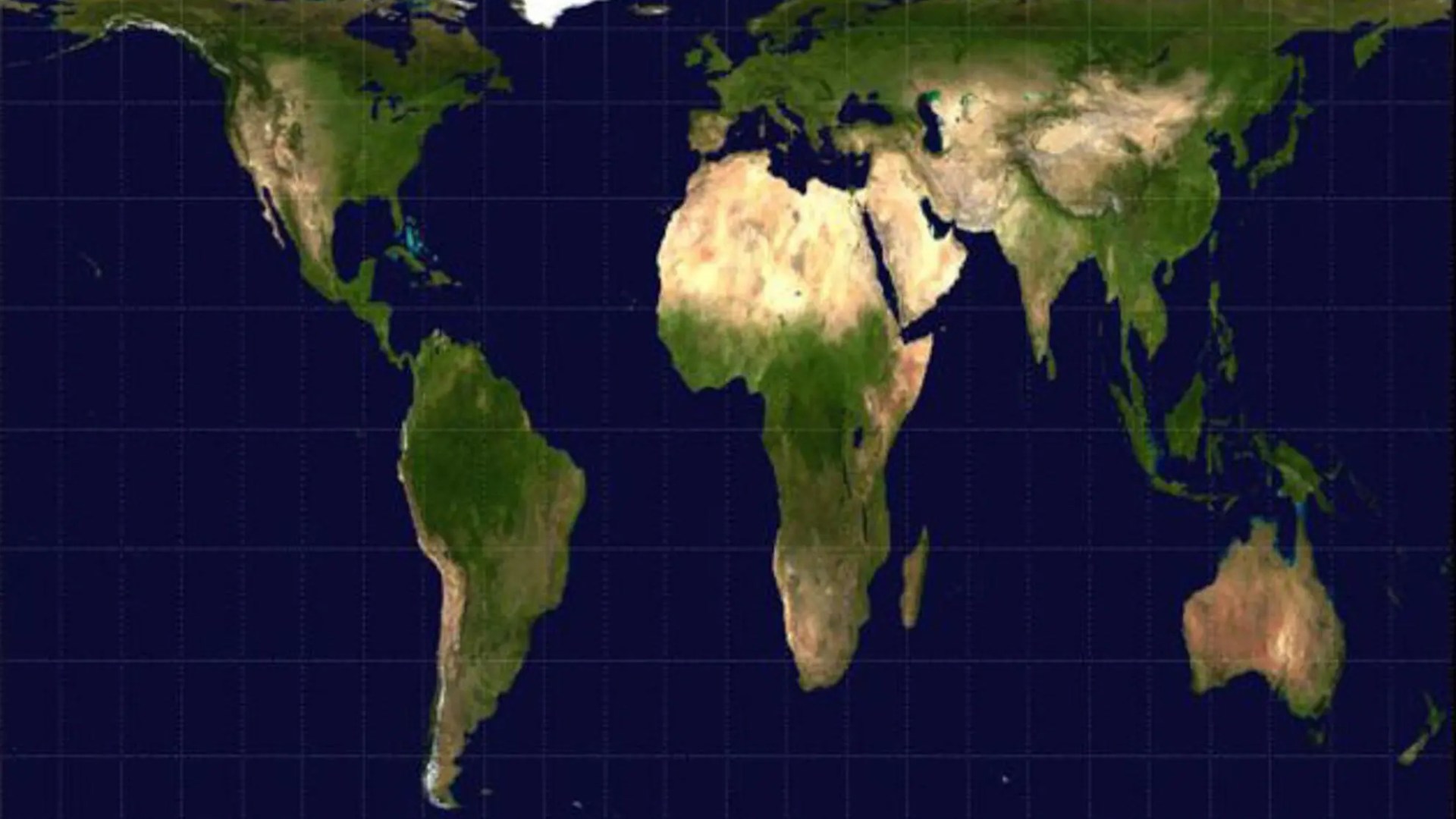
A NEW world map has officially been adopted after a UN vote – with the fresh model reducing the size of Britain and the US while making Africa bigger.
The landmark resolution means the traditional Mercator map – which the planet has been using for 500 years – will be replaced with a 2018 version.
The Mercator greatly exaggerates the size of several countries and continents based on how far they are from the equator.
Africa‘s true size for example, is not properly represented compared to countries like Russia, Canada and Greenland.
The US was the only nation to vote against the resolution.
Washington said the new map was designed to fit an “ideological agenda” and distracted from “genuine problems of international peace, prosperity or good relations”.
read more world news
CLOSE SHAVE
Airline defends stunt over stadium as passenger planes soar 50ft above roof
PLANE INSANE
Every angle of terrifying flyover as planes almost collide over rugby stadium
The new ruling was hailed by the Africa Union – who said the old map’s distortions had given the continent a “symbolic minimisation”.
Negotiations were led by Togo, who argued the Mercator map had made “lasting cognitive, educational, cultural, geopolitical and socioeconomic effects, contributing to a drastic reduction in the perceived size of Africa and other regions of the world in the global collective imagination”.
Governments, schools, and international groups are being encouraged to adopt the new map, named the Equal Earth projection, which was made in 2018.
But the new ruling does not force nations to abolish the old format.
Most read in The Sun
‘REMEMBER’
I made deal with God & I’ll make sure world never forgets 9/11, says firefighter
DEATH SENTENCE
TV presenter, 39, among 11 sentenced to death in Egypt for drug crimes
‘CASH COWS’
Green Party chief owns buy-to-let properties despite landlord crackdown vow
The map the world is used to seeing was devised by Gerardus Mercator, a Flemish cartographer, in 1569.
It allowed sailors to navigate using straight lines that correspond to compass directions.
But the maps format means landmasses appear larger the further they are from the equator.
Greenland is roughly the same size as Africa on the old map – despite the Danish territory being 14 times smaller than the continent.
Robert Dussey, the foreign minister of Togo, said: “A map is never neutral.
“It shapes perceptions, influences how the place of peoples and continents in the world is understood and may, sometimes from the earliest years of schooling, perpetuate representations that do not correspond to geographic reality.”
Before the vote on Friday, Jean-Noël Barrot, the French foreign minister, spoke in support of the resolution.
Many saw it as an attempt to show solidarity with France‘s former colonies.
He said: “[We] will abandon the Mercator projection in favour of map representations tailored to specific uses, more faithful to actual surface areas and in line with the recommendations of cartographers and scientists.”