
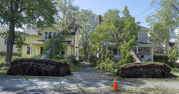
Hurricane season is looking quite different this year in the Maritimes, thanks to warming waters down south.
So far, no hurricane has formed in the Atlantic basin despite the fact that the climatological peak of hurricane season, Sept. 10, has already passed.
And as of Monday, El Niño has officially reached super status, according to data from the National Oceanic and Atmospheric Administration (NOAA).
For Maritimers, who brace for hurricane season each year, it means the active storms are on hiatus.
“Right now, we’re going the longest we’ve gone in about 75 years without a hurricane forming yet,” said Ian Hubbard, a meteorologist with the Canadian Hurricane Centre.
“It was 1941, the last time we went this amount of time in the Atlantic hurricane season without a storm actually becoming a hurricane … and that is due, in part, to effects of El Niño.”
Story continues below advertisement
To declare an El Niño, ocean temperatures in a particular region of the tropical Pacific must generally clear 0.5 degrees Celsius above the long-term average.
The informal threshold that classifies it as a super El Niño is two degrees. A super El Niño can lead to more vertical wind shear, or a difference in winds in the atmosphere based on height.
“That actually is not a very good thing for tropical storms when they’re trying to form. So it tends to really rip them apart at the higher levels,” said Hubbard.
Get breaking National news
Get breaking Canada news delivered to your inbox as it happens so you won’t miss a trending story.
By providing your email address, you have read and agree to Global News’ Terms and Conditions and Privacy Policy.
Hurricane season runs from June 1 to Nov. 30.
The Atlantic basin has had only five named storms so far this year, while an average season has about 14 storms and seven hurricanes, says Hubbard.
The Canadian Red Cross is heavily involved in hurricane preparations and relief efforts across the region, but this year, their efforts have been focused elsewhere.
“It is a different feeling, I guess, compared to previous years. But that doesn’t stop the work that our organization does to be prepared to respond to natural disasters of any kind,” said Ancel Langille, the Canadian Red Cross’ emergency management director.
“A week and a half ago, we were actively responding in Cape Breton when they had that extreme amount of rainfall.”
Story continues below advertisement
0:29
Cape Breton swamped by severe floods, more rain on the way
- Tornado confirmed in Winnipeg neighbourhood, another west of the city
- ‘A lot of work ahead’: Storm-ravaged Saskatchewan cities continue cleanup
- ‘Warzone’: Storm rips through Winnipeg leaves thousands without power
- 2 Cape Breton counties lift states of emergency as flooding recovery continues
-
Statistics Canada report: More than 85,000 Metro Vancouver homes are in high flood-risk zones
-
City pursuing legal action as fire continues to burn at southeast Calgary landfill
-
Global News at 6 Saskatoon: Sept. 14
-
Global News at 6 Regina: Sept. 14
While it’s been a quiet hurricane season, extreme weather is still very much a risk.
Environment and Climate Change Canada (ECCC) forecast this past January that this year “will likely be among the hottest years on record.”
Combined with the warmer global temperatures that El Niño causes, this can amplify conditions like drought, heavy rain and flooding, and warmer-than-usual winters.
For the Red Cross, that heavy rainfall earlier this month, which claimed the life of a 46-year-old woman in Richmond County, highlights the importance of emergency preparedness regardless of the forecast.
“Now is the time to prepare before the storms hit,” said Langille.
In a statement, the province’s Department of Emergency Management says that while a quieter hurricane season is “certainly welcome news for Nova Scotians,” it doesn’t reduce the potential impact of a single storm.
Story continues below advertisement
“It only takes one hurricane or post-tropical storm affecting our province to cause significant damage, disrupt essential services, and impact communities,” the department said.
“Hurricanes are also not the only risk Nova Scotia faces in terms of emergencies; the recent flooding in Cape Breton is a prime example of the devastation any type of storm can cause.”
Hubbard echoes that sentiment, saying it’s “important to pay attention.”
“Even though it’s been quiet and we’re expecting it to remain below normal this season, we still have a month and a half of what we consider to be the busiest time of year,” he said.
— with a file from Global News’ Adriana Fallico