
Big Half 2026 route map, road closures, best places to watch and nearest stationsThousands of runners will run 13.1 miles across four London boroughs this Sunday
Allow Exco Player content
This content is provided by Exco Player and may use cookies or similar technologies. Please click ‘Allow and Continue’ below to load the content.
Niva Yadav1 minute ago
COMMENTS
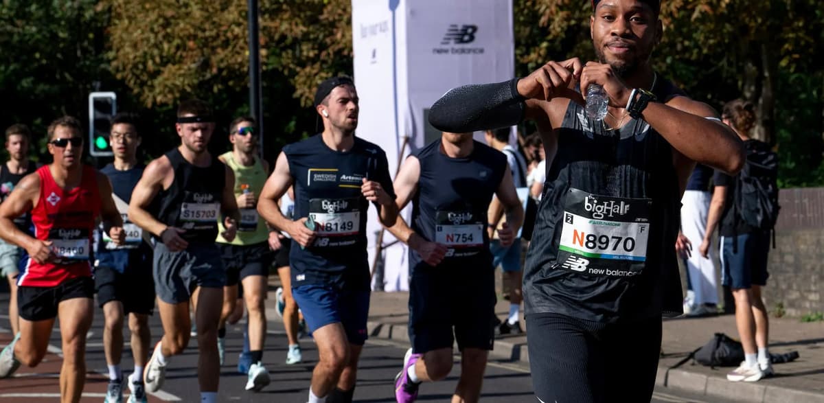
Thousands of runners are set to hit London’s streets on Sunday as the Big Half arrives in the capital.
The Big Half, organised by London Marathon Events, was launched in 2018 in a bid to celebrate the capital’s running community and make mass-participation running events more accessible.
The event will also include the New Balance Big Relay – sponsored by the sports footwear brand – which will see groups of up to four people complete equal legs of the half-marathon distance together.
There will also be a family-friendly run, the Big Mile, which finishes at the same point in Greenwich, as well as a festival zone in Greenwich Park, which will be open to the public for free.
It comes as a record 1.33million people entered the London Marathon 2027 ballot, showing a growing popularity for mass-participation running events in the capital.
Everything you need to know about the Big Half 2026
London Marathon Events
What is the Big Half route?
The 13.1 mile route covers four of the six boroughs included in the full London Marathon, namely Tower Hamlets, Southwark, Lewisham, and Greenwich.
The Big Half begins near Tower Bridge, before heading into Limehouse and towards Canary Wharf.
The run will then loop around to Wapping and back across Tower Bridge. Runners will then make their way through Rotherhithe and Surrey Quays, before the home stretch Greenwich – where the full London Marathon usually starts.
As runners cross the finish line, the Cutty Sark will be in view, marking a picturesque finish to the 13.1-mile run.
There are plenty of great places to watch along the route, including community cheer zones.
There is an accessible viewing area near the Finish Line at Cutty Sark for spectators with disabilities.
Tower Bridge and Cutty Sark can get extremely busy, so arrive in good time if you want to watch your loved ones there.
What is the relay and Big Mile route?
The relay route will be the same as the Big Half route, but participants will join at different points in the race.
Read More
Who are the candidates to replace Keir Starmer in Holborn and St Pancras by-election?
All On The Board co-creator marks 25 years on Underground with special poem
London’s first robotaxis hit the streets: Everything you need to know
Make 2026 the year of working smarter
These points are near Tooley Street, at Harbord Square in Canary Wharf, outside Wapping Rose Gardens, and at Salter Road in Rotherhithe.
The Big Mile will begin at 2:30pm at Creek Road, heading towards Deptford. The route will then go back on itself through Greenwich, finishing at the Cutty Sark.
What time is the Big Half?
The Big Half officially kicks off at 8:30am. There will then be staggered starts every 19 minutes.
Participants have four hours to complete the race. Those who don’t finish within the time will have to run on the pavement to complete it.
How to get to the Big Half?
Due to road closures, public transport is your best bet to reach the Big Half – whether you’re a spectator or a participant.
The stations closest to the finish line include Cutty Sark on the DLR, Greenwich, Deptford, or Maze Hill stations.
For the start of the race, Tower Bridge, Tower Gateway, Fenchurch Street, and London Bridge are within walking distance.
What roads are closed?
Multiple roads across Southwark, Tower Hamlets, Lewisham, and Greenwich will be closed to allow for the Big Half.
Road closures will begin from between 4am and 8am on Sunday and remain in place until between 2pm and 4pm on the same day.
Full list of road closures during the Big Half
- Tower Bridge Approach 04:00 – 14:00
- Tower Bridge 04:00 – 14:00
- Tower Hill 04:00 – 14:00
- East Smithfield 04:00 – 14:00
- Limehouse Link Tunnel 04:00 – 14:00
- Aspen Way 04:00 – 14:00
- The Highway 06:00 – 14:00
- Butcher Row 06:00 – 14:00
- West India Dock Road 06:00 – 14:00
- Trafalgar Way 06:00 – 14:00
- Churchill Place 06:00 – 14:00
- North Colonnade 06:00 – 14:00
- Upper Bank Street 06:00 – 14:00
- Bank Street 06:00 – 14:00
- Heron Quays 06:00 – 14:00
- South Colonnade 06:00 – 14:00
- Canada Square 06:00 – 14:00
- Cabot Square 06:00 – 14:00
- West India Avenue 06:00 – 14:00
- Westferry Circus 06:00 – 14:00
- Westferry Road 06:00 – 14:00
- Salter Street 06:00 – 14:00
- Limehouse Causeway 06:00 – 14:00
- Narrow Street 06:00 – 14:00
- Garnet Street 06:00 – 14:00
- Wapping High Street 06:00 14:00
- Thomas More Street 06:00 – 14:00
- Tooley Street 06:00 – 15:00
- Jamaica Road 06:00 – 15:00
- Brunel Road 06:00 – 15:00
- Salter Road 06:00 – 15:00
- Redriff Road 06:00 – 15:00
- Quebec Way 06:00 – 15:00
- Canada Street 06:00 – 15:00
- Surrey Quays Road 06:00 – 15:00
- Lower Road 06:00 – 15:00
- Lower Road 06:00 – 15:00
- Evelyn Street 06:00 – 15:00
- Deptford Church Street 06:00 – 15:00
- Creek Road 06:00 – 16:00
- Greenwich Church Street 06:00 – 16:00
- College Approach 06:00 – 16:00
- King William Walk 06:00 – 16:00
- Nelson Road 06:00 – 16:00
- Greenwich South Street 06:00 – 16:00
- Greenwich High Road 06:00 – 16:00
- Romney Road 06:00 – 16:00
- Trafalgar Road 06:00 – 16:00
- Haddo Street 12:30-15:30
MORE ABOUT