
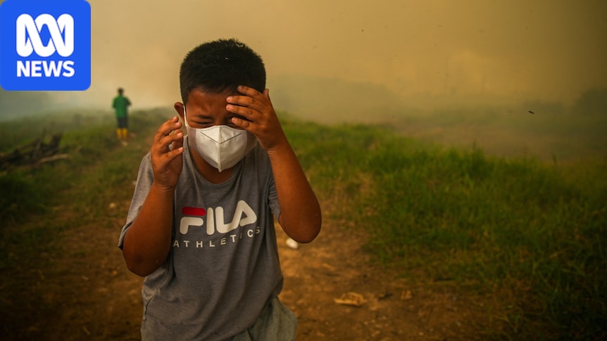
Indonesia battling wildfires as smoke haze spreads as far as the PhilippinesBy Erwin Renaldi with graphics by Alex Lim and Jarrod Fankhauser
Posted Fri 4 Sep 2026 at 3:09pmFri 4 Sep 2026 at 3:09pmFri 4 Sep 2026 at 3:09pm
For most of the year, Indonesia has been battling wildfires, which have intensified in recent weeks.
The resulting haze has spread as far as Singapore, Malaysia, Brunei and the Philippines.
The Indonesian government said six provinces on the island of Sumatra and in Kalimantan were the focus of firefighting efforts.
Fire spots were also reported in Java and on Sulawesi island, as well as in West Papua.
The haze has put the health of millions of people at risk across the islands and in neighbouring countries, as well as threatening endangered orangutans.
How big are the wildfires?
According to Indonesia’s Forestry Ministry fire-monitoring service (SiPongi), wildfires have burned more than 202,000 hectares across the country from the start of the year to June, nearly three times the size of Singapore.
In July alone, almost 95,000ha were burned, including more than 73,300ha in Sumatra and Kalimantan.
There is no official data for August yet.
The most affected area was West Kalimantan, which is home to wild orangutan populations living in national parks and conservation areas.
Before: Kalimantan on August 18. . After: Kalimantan on August 29 (Source: NASA, ABC News Graphic by Jarrod Fankhauser). .
Instructions: Use left and right arrow keys to control image transition
SLIDE
Before: Sumatra on August 21. . After: Sumatra on September 2 (Source: NASA, ABC News Graphic by Jarrod Fankhauser). .
Instructions: Use left and right arrow keys to control image transition
SLIDE
“We urge the public to always increase their vigilance and preparedness in facing potential disasters, especially in areas with drought and wildfires emergency status,” the National Disaster Management Agency (BNPB) said in a statement.
What was the cause?
According to Indonesia’s Meteorology, Climatology, and Geophysical Agency (BMKG), a strong El Niño caused drought in most parts of the country, but an ignition source such as human activities was still needed to start the fires.
Indonesia’s Ministry of Forestry said it had identified several alleged causes.
In a statement, the ministry outlined several cases where land was illegally sold and then burned for oil palm plantations.
There were also cases of forest fires being used to clear land for authorised road construction.
Last week, Indonesian police arrested 72 people on suspicion of starting forest fires.
Investigators were still tracing financial records to determine whether companies financed or ordered the land clearing, signalling the probe could expand beyond those arrested.
“We will continue to oversee, and every finding will be followed up in accordance with the nature of the violation,” said Dwi Januanto Nugroho, the director-general of Forestry Law Enforcement, in a statement.
According to a report by Pantau Gambut, a peatland watchdog group based in Indonesia, the country is one of the world’s largest tropical peatlands, with most peatlands in Sumatra, Kalimantan and West Papua.
The watchdog group said peatlands have the highest carbon storage capacity of any type of land or vegetation.
When peatlands become degraded due to conversion into plantations or industrial areas, they become dry and highly flammable.
There are significant environmental impacts when they catch fire through the release of greenhouse gas emissions.
Pantau Gambut said clearing peatlands for oil palm plantations could release more than 427 tonnes of carbon per hectare.
How is the government tackling the fires?
According to the latest data from BNPB, more than 39,000 people have been deployed as part of a joint operation to extinguish the fires.
Military personnel, police officers, Ministry of Forestry and local government personnel, as well as volunteers have been involved in the operation.
Firefighters are conducting both ground and aerial operations, including water bombing and weather modification efforts, although they said they have faced several challenges.
“The main obstacles in the field include difficult access to the location, the distance to water sources, the vast expanse of land, and wind and smoke conditions that hamper extinguishing efforts,” said Berton Panjaitan from the disaster management agency.
Toxic haze spreads across South-East Asia
Haze from the wildfires has spread to parts of neighbouring countries, according to local media reports.
On Tuesday, several areas in Malaysia’s Sarawak state, which shares a border with Indonesia on Borneo island, recorded “unhealthy air quality” levels.
The Malaysia’s Ministry of Health said asthma cases surged 259 per cent in the last week of August amid worsening air quality.
In the Philippines, a new air quality report released by the ASMPH Center for Research and Innovation (ACRI) and the Breathe Metro Manila (BMM) network showed that the haze from Indonesia fires had pushed the capital city Manila’s air quality to “acutely unhealthy” levels between August 30 and September 2.
The research found that air pollution levels were more than four times the World Health Organization’s recommended guideline.
Last week, the ASEAN Specialised Meteorological Centre activated a Level 3 alert, the highest trans-boundary haze alert, for the southern part of South-East Asia.
“Several air quality stations in West and South Kalimantan, central and southern Sumatra, as well as western Sarawak recorded unhealthy to hazardous levels,” according to a statement cited by the Bernama news agency.