
This section is The content in this section is supplied by GlobeNewswire for the purposes of distributing press releases on behalf of its clients. Postmedia has not reviewed the content. by GlobeNewswire Article content
The Weather Network’s 2026 Fall Forecast
Sign In or Create an Account
or View more offersArticle content
OAKVILLE, Ontario, Sept. 09, 2026 (GLOBE NEWSWIRE) — El Niño continues to intensify and is projected to become the strongest El Niño event on record. With an exceptional El Niño taking over as the dominant influence on fall weather patterns, can we anticipate a season filled with extreme weather?
Article contentWe apologize, but this video has failed to load.Try refreshing your browser, or
tap here to see other videos from our team.Article content
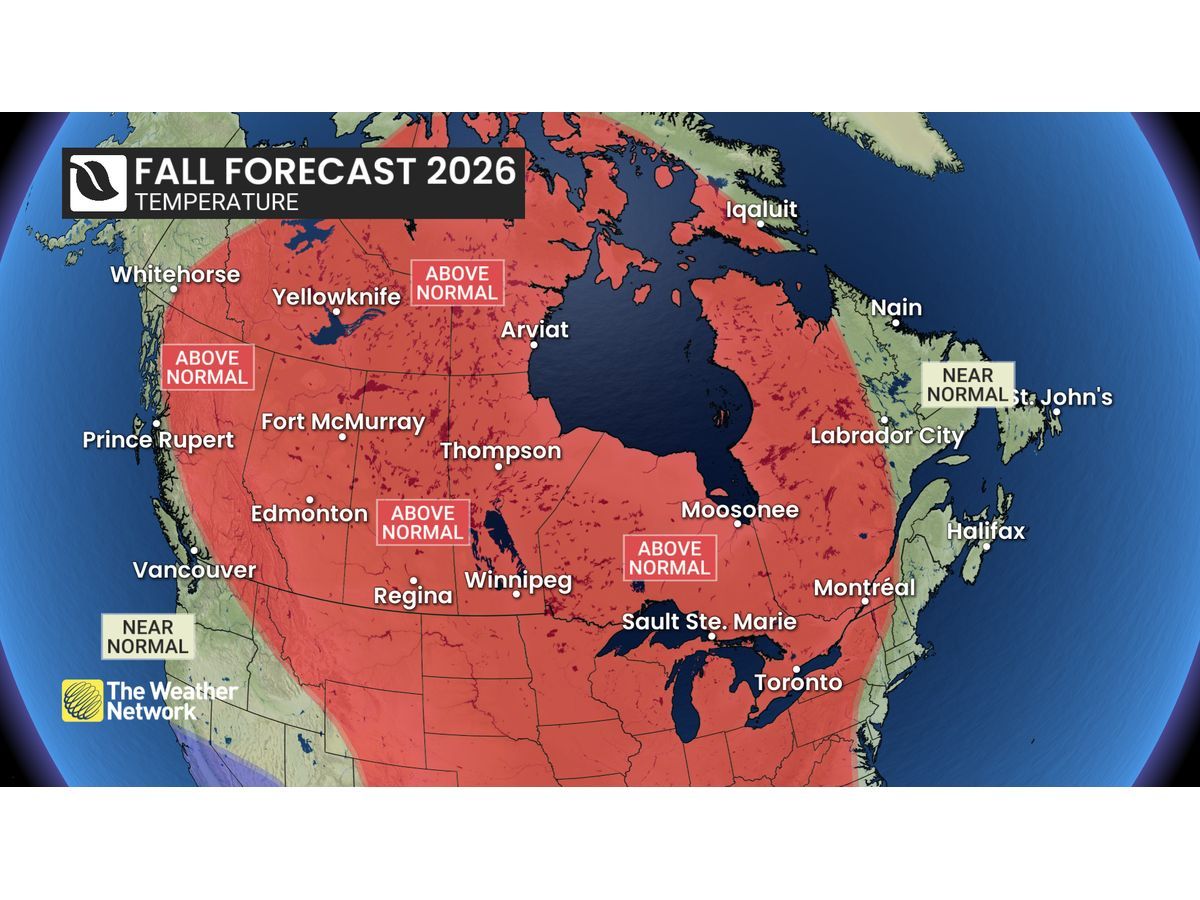
To answer this question, The Weather Network has released its fall forecast for the rest of September, October and November.
Article content
Story continues below
This advertisement has not loaded yet, but your article continues below.
Article content
“While many parts of the world are bracing for the impacts of a historic El Niño, Canada is not expected to feel the brunt of its effects,” said Doug Gillham, Senior Meteorologist at The Weather Network. “In fact, El Niño could have a moderating influence on some of the weather extremes that we might otherwise experience.”
Article contentArticle content
Fall storms are legendary across Canada and we are still at risk for a few high-impact storms this season. However, we expect fewer classic fall storms than we typically see during October and November. We should also see fewer hurricanes in the Atlantic and we expect a delay in the arrival of consistent winter weather. This will give most of Canada an extended fall season.
Article content
Fall is notorious for fickle temperatures and this year will be no exception with shots of chilly weather offset by periods of warmer weather. However, mild conditions should win out in the end across most of Canada.
Article content
What is El Niño?
El Niño is associated with warmer-than-normal ocean water temperatures in the tropical region of the Pacific Ocean to the west of South America. This has an impact on the global jet stream pattern.
Article content
Story continues below
This advertisement has not loaded yet, but your article continues below.
Article content
Here’s a more detailed look at the conditions that we expect across Canada this fall:
Article content
British Columbia
Early September has delivered much-needed relief from the hot and dry conditions that we endured for much of the summer. Looking ahead, most of the province will be warmer and drier than normal during the second half of September and well into October, especially across the interior, but the worst of the heat is in the rearview mirror. However, coastal areas will be near seasonal, and a more active late season pattern should bring precipitation totals close to normal. We expect a delayed start to winter for most of the province, but alpine regions could be just cold enough for substantial snow as we approach the start of the ski season.
Article content
The Prairies
Warmer-than-normal temperatures are expected to dominate during much of the fall season, but there will be chilly interruptions along the way which will include some early winter-like weather. However, while early winter conditions may threaten at times, mild temperatures will return during November and into December with a delayed start to consistent winter weather. Precipitation totals are expected to be near normal across southern Saskatchewan and southern Manitoba and below normal elsewhere.